Saturday 8 February 2014

Unchalli falls

Yellapura is famous for many beautiful waterfalls, our initial plan was to visit Magod Falls which was near Yellapura, but last minute we changed our plan and decided to go to Unchalli falls. We had planned to vacate the home stay by 9.00 a.m. after having our breakfast.


Meanwhile we went to home stay owner to check any interesting place other than our scheduled places. he guided us for a small trekking. I don’t call it as a trekking as it was just 1 KM away from the home stay. place was good but again we were in right place at wrong time and missed the sunrise which will be awesome as said by our home stay owner. Clicked couple of pics around the place and headed back to home stay.


Once we are done with breakfast, packed up our things and said good bye to our home stay which was indeed a good place to stay.

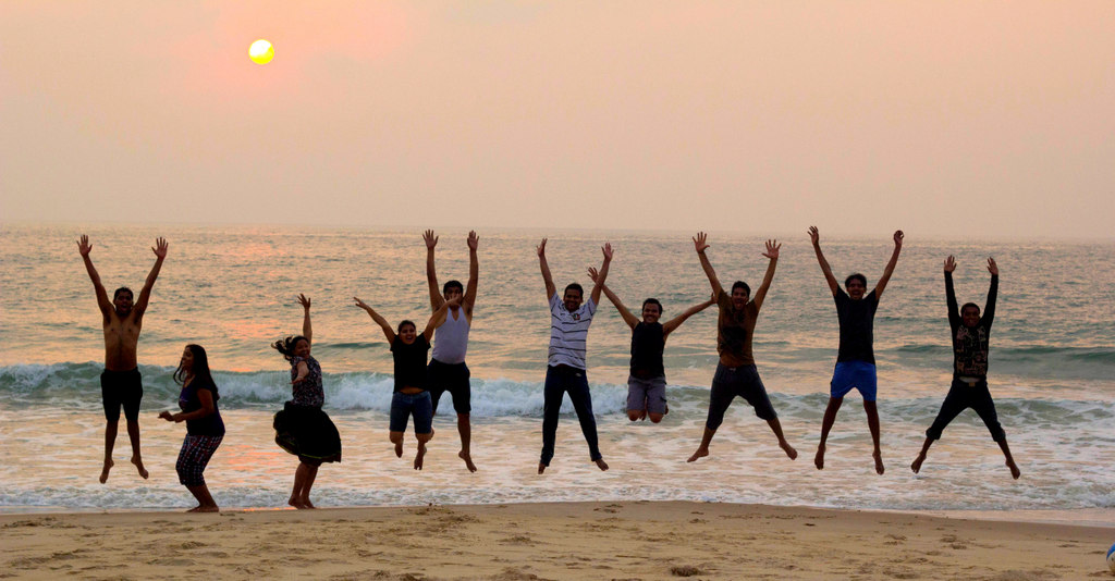
Group  pic in front of home stay:


After few clicks we started our way towards Unchalli falls. Route was unknown as you know it was a last minute decision. We took help of localities over there to reach the place and  finally reached the place @ 11.00 a.m. The view point of water falls is  just a distance of 500mts From the parking place.  As we came near to the view point of the falls, we could hear the thunder sound of the water. I was so mesmerized and it was so embracing sound. so I  started running in an eager to see the falls. It was simply superb and nature was at its best. I started capturing the beauty of nature.

Here we go…Unchalli Water falls… simply superb…


We had planned to spend some 1 hour here and leave for Bangalore as its hard for us to reach early due to worst traffic in Bangalore But seeing the view point of the falls we felt like going near and somehow we managed to reach the falls.


It was a wonderful experience for me and this was the  3rd trekking for me in last one month. If I am not wrong we have to walk almost 3Kms to reach the waterfalls (since nowhere it’s mentioned about the distance I just guessed it).  Two of us reached the waterfalls first and we waited for the remaining guys to join us. We waited there for almost 20 to 30 mins for other members and thought they might have backed off the trekking but I was wrong. All our group members reached down one by one.


1st challenge was to find out the falls route and we managed to find and next is to find the way through hard core rocks to down/near to falls and we did that too.

Loved this trekking a lot. Place was really a must go one. Only thing we did not do is playing in water due to time constraint.

Group pic in Unchalli falls:


We spent some time here, relaxing to gain energy to go back to TT near parking place. Relaxed, Enjoyed and started back to Bangalore.

Special kudos to Guru for organizing this trip and am glad to have gone to this trip with them.

Overall a must go places. But better to plan after monsoon to be in a right place at a right time…

Cheers…

Ramanagindi Beach

Ramanagindi Beach was the last destination for the day for us. As planned earlier, explored Mirjan Fort first thing in the morning and finished our lunch near Apsarakonda Beach and reached Ramanagindi beach by sunset time. Ramanagindi beach is around 25 Kms from Apsarakonda beach.

Reached around 5.00 P.M. and here sea shore is quite pleasant to play in water. There is no particular sign boards to reach this beach need to take localities help to reach this place.


This is one of the peaceful beach I visited, apart from our gang no one else was around ðŸ˜Š

Some of the guys started playing in water, I kept myself busy in capturing beautiful sunset in my camera..


Spent some quality time with awesome group, clicking some group pics and enjoying the sunset. A sunset to remember. Sunset-Awesomeness at its best. We were done for the day and started our way  back to  home stay ‘Éden Garden’ which was hardly 10 mins drive from this beach.

Friday 7 February 2014

Apsarakonda Beach

Apsarakonda beach is less crowded beach at 2 km distance from the highway. You can witness the full length view of the beach from the top viewpoint and it’s the best place to sit and relax especially during the sunset. Apsarakonda is near Honnavar (around 6 Kms), around 20 Kms from Kumta. After spending some time at Mirjan Fort headed toward Apsarakonda beach.

Estimated time to reach our destination was not more than one hour, but because of one major accident road was closed for couple of hours and took more time to reach our destination than we planned. Reached Apsarakonda around 3.00 p.m.

About Apsarkonda Beach: Apsarkonda means Pond of angels. This is named after a pond facing the Beach. The legend associated with the name of the waterfall is that it was the chosen place of the angels to take a bath and relax.

There is Maha Ganapati and Ugra Narasimha temple, behind which you find Apsarkonda waterfalls. There is a Pandava caves which is of historical significance. According to mythology Pandavas stayed during their Vanavasa.

Plan was to have our packed lunch in park, enjoying the top view of beautiful beach.


Once we are done with lunch headed towards water falls. During summer it will be dry.


Since water level was too low, just spent couple of minutes near waterfalls and headed towards beach.

Once we enters sea shore we can see some sign boards waring the visitors to not to get into water. But I liked this quote more!


Walked for some time around the sea shore and had a quick photoshoot.


Since we were advised to not to get into water at Apsarakonda beach by our home stay owner (because of our safety) and he only suggested about Ramanagindi Beach.

After spending couple of hours near Apsarakonda beach headed towards Ramanagindi Beach.

Mirjan Fort

Trip around Honnavara was planned and organized by Guru. As per plans we were supposed to gather near Mejestic Railway station @ 9.30 p.m. As usual and as always we were bit late (I call it as a bit..:P) and reached Majestic by 10.30 p.m. I must tell about the craziest auto ride to reach Mejestic. Since we were bittt… late, we decided to hire an auto instead of waiting for bus. We got into auto from Hoskere halli. We 3 (Varun, Guru and me) were totally scared by the auto speediness and were thinking we won’t reach our destination for sure and in case we did, we won’t be in a good condition to start trip. Finally by god’s grace we could able to make out to majestic safely in good condition. This time it was a TT we had hired for the trip. We were a team of 11 members for this trip (Guru, Varun, Mirza, Vijay, Asit, Vinod, Pavithra, Ashwasan, Jayashree, Sowmya and me).

As soon as all gathered, we started our journey @ 11.30 p.m. All of us were too tired due to hectic work schedule at office and due to horrible traffic, we all had exhausted completely on the way to pick up points. We were literally waiting to start our journey and have some sleep in TT.  

Plan was to reach Kumta where we booked Home Stay and then visit Mirjan Fort. Kumta is around 460 Kms from Bangalore and easily its 10 hours journey. With many quick stops for tea reached our destination “Eden Home Stay” around @ 9.30 a.m.

We had our breakfast at home stay and started to Mirjan Fort as per our plan which was almost 10Kms from our home stay. We reached there around @ 11.00 a.m. which was very bad time to visit the place as well as to click photos. Usually I prefer early morning or evening times to click photos. Place was good, but it was too hot to feel the goodness of the place (Can’t expect cold breeze in costal part that too at that lazy hours of hotness at 11.00 a.m.)

History of Mirjan Fort: Believed to be built in the 16th century, the actual history of the fort is still unknown though there are many legends on who actually built the fort. The most famous one is the story of Queen Chennabhairadevi of Gerosoppa or famously known as the ‘Pepper Queen’ who controlled the pepper business through this fort. But as per the board at the entrance of the fort, it is built by Sharif-Ul-Mulk who was ruling Ponda as the feudatory of the Adil Shahi Sultan of Bijapur. The fort served as an important port for overseas trade during the medieval period. Currently the fort is maintained by the Archaeological Survey of India (ASI) as a protected monument.


Best time to visit the fort is during monsoon, as you will get to see the fort full of green grass and will be awesome to look into fort covered with greenness. We were at the wrong time in the right place… and hence could not feel the nature’s beauty as like in pics (of this place as in Google). 

So when you are in the right place at wrong time, the only option remains is at least capture the moments. Got couple of pics which came out well. After some circus  with the camera timer set for 10  Secs, and I got below pic which  is One of my all-time favorite clicks.


I should thank everyone for baring me in such a hot weather on the fort posing for camera. I made them to wait there for atleast 15 mins to get the good click.

Spent some good time roaming around the fort and then started to our next destination Apsarakonda beach, plan was to have lunch at this beach and reach Ramanagindi beach by sunset time ðŸ˜Š


Saturday 1 February 2014

One day trek to Savandurga

Date: Feb 1st 2014

Places covered: Savandurga, Manchinabele Reservoir & Doodaladmara (Big Banyan tree)

Total Distance traveled:110Kms.

About Journey: It was long time I went out on my bike for a long ride, wanted to go out for a ride. Checked with my friends for weekend ride to Hogenekal falls, but no one was ready for bike rides. Dropped plan of riding to Hogenekal falls, but I wanted to go out for a ride. Winter was about to end and already we were sensing the summer by the end of January only. Friday evening I called Guru and asked about his plan for weekend, he said he is free and ok to join me for a ride. Called another friend Srinivas and asked him if he is interested to join us or not. Even he said ok. It’s all set for the ride, we have decided to start early in the morning. 

Saturday morning Srinivas joined me near my home @ 6.30 AM and on the way we picked Guru. We have plenty of options to reach Savandurga. We can take Bangalore – Magadi road,  Bangalore – Ramanagara Road then from Ramanagara need to go towards Magadi (it’s quite long distance), or on the way to Ramanagara after Rajarajeshwari medical collage need to take right towards big banyan tree (we thought of taking this route while coming back), We took Tavarekere route to reach Savandurga. Near Kengeri need to take right towards outer ring road, then near Shell petrol bunk need to take left, its one straight road which joins to Tavarekere. Usually I prefer this road for bike ride, not much traffic in this road, bit lonely too and good for jolly rides. From Tavarekere again it will join to Magadi main road. Once we reach Magadi need to take Ramanagara road to reach Savandurga. After 10 Kms from Magadi towards Ramanagara we will get place called Nayakanapalya. Again from Nayakanapalya we need to take left to reach Savandurga. It’s around 3 Kms to reach. Road is not that good, but work was in progress. But still it was nice ride after long time.

Savandurga:

Savandurga hill is considered to be one of the largest monolith hills in India and the trip is best for Trekking and good weekend getaways in Bangalore. Savandurga hill is located at an altitude of 1226 m above the sea level. They serve as the base for pilgrims who come to visit the Narasimha Swamy temple, situated at the base of the hills. The paths leading to these hills are quite uneven and thrilling. Thus, they make it to the wish-list of the rock-climbers, cave-explorers and adventurers.


We reached Savandurga around 8.00 AM, since it was not planned day out we not even had our breakfast and didn’t arranged any alternatives too. Near temple we will get few shops who sell some snacks, purchased some snacks and without any delay we started climbing the hill. We will find arrow mark which shows us the better path to climb. If we won’t follow the arrow mark then definitely we need to struggle and we will be in danger. It will take minimum 1 hour to climb the hill and reach the peak, but still it depends on our stamina and number of breaks which we take in between.   

Few forts are built on the fort. History tells that Kempegowda built this fort (I am not going to cover this part, since I am bit poor in History :P). We can see few foot prints of horses too near one point. 


From this point if we look around we can see the back water of Manchinabele Reservoir, I just like that view. If the Reservoir is full hopefully it will be more beautiful. Most of the time it won’t be full (this was the 5th time I was climbing this hill, but all the times the reservoir was dried out or half filled). 


We were not in any hurry just enjoying the beauty of the nature around and the cold breeze.  Spent some time to click pics to (as always :D).

At one point we will get flat route and some Mantapa is built in that place, don’t know exactly for what purpose it built. As I heard from people, soldiers use to take rest in this place. It’s really simple and beautiful place. 


Reached the peak without much struggle. At the peak of the hill one Basava Mantapa is there. Relaxed for some time at the peak, had some snacks and gained back the energy to get down from the hill. Didn’t took much time to get down. By 11.00 AM we got down from the hill and our trekking was ended within in 3 hours. 


Since we had lot of time left for the day, we decided to cover Manchinabele Reservoir & Doodaladmara (Big Banyan tree) while going back to Bangalore.  

From Savandurga to Manchanabele Reservoir its almost 15 Kms towards Ramanagar road. Near village called Veeregowdan doddi need to take left deviation to reach Manchanabele Reservoir. View of sun set will be good at Manchanabele Reservoir, but unfortunately now they won’t allow any one into the Reservoir. But on road only we can enjoy good view of reservoir. 


Spent some time near the reservoir and headed towards Dodda Aalada Mara. It’s around 10 Kms from Manchanabele. 

Dodda Aalada Mara:

Dodda Aalada Mara (Big Banyan Tree) This big banyan tree is a 400 year old tree and considered 4th biggest banyan tree after world’s biggest tree at Andhra Pradesh, Kolkata and Adiya tree at Chennai. The tree now lives without its main trunk. The main tree has over the years spread out widely with several acrial roots. With thousands of such roots spread out. the tree covers an area of 3 acres. The present crown of tree has a circumference of about 120 mts and the highest branch rises to about 95 feet’s.


In past few years lots of Kannada movies shooting took place here.  Went for a walk across the tree and spent some time in the park.

Headed back to Bangalore and reached Bangalore by 4.00 PM.

It was a short and nice ride around the city and enjoyed my ride too :) 

Vagamon Heights

After enjoying the morning Jeep drive to Ullupooni, we decided to relax at the resort. For the evening, we planned to visit Vagamon Heights,...